Papercraft Map Template with Integrated Protractor
Download PDF ↓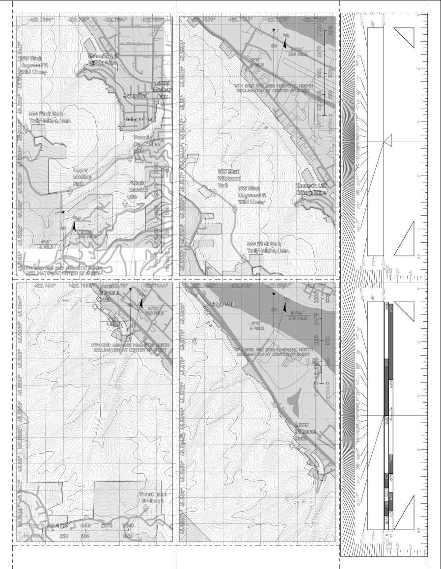
Overview
A printable papercraft map template featuring four integrated 3 in x 5 in map frames and a map slot protractor — a fascinating tool I came across in a WWII era British Air Corps land navigation manual. The end result is something you can cut out with scissors and use, along with a compass, for precision angle-measurement, navigation and bearing work, or GIS education.
Design Goals
A standard field map and a protractor are two separate tools. When you need to take a bearing from a map, you place the protractor on the map, align it and read the angle. Then with the integrated ruler and scale(s) — 1:25000 and 1:24000 are represented as general land navigation standards on foot — you can estimate routes, identify POIs or locate control points the old fashioned way, as long as you know your pace count and your compass is true.
The target user is anyone doing map-based navigation, orienteering, or field GIS work who benefits from a lightweight, printable, expendable tool rather than carrying dedicated equipment.
Design Process
Protractor Geometry — Civil 3D
Civil 3D was chosen for the protractor geometry because it provides the precision needed for accurate angular and dimensional markup at print scale. The slot protractor, degree markings, and alignment lines were drafted as Civil 3D objects with exact angular divisions, then exported at the correct scale for integration into the map template.
The geometry had to be precisely registered to the map’s true north orientation so that bearings read from the protractor are directly transferable to the map’s coordinate system without correction. The magnetic declination of the map area is provided for compass bearing adjustments.
Map Template — ArcGIS Pro
The surrounding map template was built in ArcGIS Pro, providing the standard cartographic elements — grid, scale bar, north arrow, and map frame — that give the protractor spatial context. The layout was designed to print in black and white on standard paper sizes (A4 / US Letter) to make the concept as accessible as possible to anyone with an interest in land navigation.
The protractor geometry was imported as a layout element and positioned to align with the map’s coordinate grid.
Fabrication
The template includes cut lines and fold lines (lifted from the visual language established in origami) for the slot protractor and the map frame. The result is a flat, lightweight tool that folds into a field-ready configuration.
Use Cases
- Field navigation and orienteering
- GIS fieldwork and ground-truthing
- Surveying education and classroom demonstrations
- Emergency management field kits where lightweight, expendable tools are preferred